

The airport opened on 14 September 1964, replacing Tromsø Airport, Skattøra, a water aerodrome. Tromsø became and still is the main hub for Widerøe's regional flights to Finnmark. Main haul flights to other primary airports were carried out by Scandinavian Airlines (SAS). Braathens SAFE and its Busy Bee subsidiary operated from Tromsø from 1967 to 2002. Norwegian Air Shuttle has flown from Langnes since 1992 and Lufttransport has its main operating base at Tromsø. The current Terminal B was built in 1977. Terminal A opened in 1997, following a period with a 240-meter (790 ft) runway extension and a new control tower.
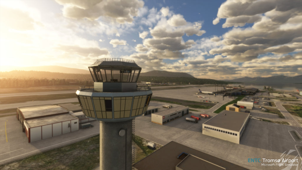
Tromsø Airport is situated at Langnes on the western part of the island of Tromsøya in Tromsø, Norway. The airport has two terminals measuring a combined 13,500 square meters (145,000 sq ft). Terminal A, opened in 1997, features the check-in and has three jetbridges. The older Terminal B, from 1977, has the international hall. Jetliner operate out of Terminal A, while regional airlines operate out of both terminals. Combined there are stands for nine aircraft.
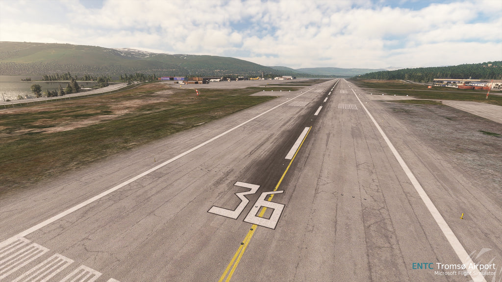
The asphalt runway has physical dimensions 2,447 by 45 meters (8,028 by 148 ft) and is aligned 01/19, almost north–south. It has a takeoff run available (TORA) of 2,447 meters (8,028 ft) on runway 01 and 2,391 meters (7,844 ft) on runway 19, and a landing distance available (LDA) of 2,391 meters (7,844 ft) on 01 and 2,003 meters (6,572 ft) on 19. All have category I instrument landing system with precision approach path indicators. The airport is equipped with category 7 fire and rescue service. The airport has a reference elevation of 10 meters (32 ft) above mean sea level.
• Accurately modelled surroundigs
• Updated CGL Data
• Real World based terraforming profile
• PBR Materials
• Ambient animated objects
• Custom interior Modeling
• New Terminal Extention (Based on real world project renders)
Available since
2022-04-19
Supported Simulators
Microsoft Flight Simulator 2020 and 2024
MSFS 2024 Native
No
Version
v1.4.1
Supported Operating System
Windows
Installation Method
Contrail App
Download Size
2.38 GB
Installation Size
4.81 GB
Gallery


