

Enhance your flights around the bays, mesas, and canyons of the San Diego metropolitan area with this package of hand-modeled bridges, coastline enhancements, and freeway interchanges.
This package contains approximately 35 detailed bridges, viaducts, and freeway interchanges, covering most major bridges/interchanges within the city of San Diego along with many notable ones in outlying areas. Central San Diego is covered by native photogrammetry within MSFS, but the poor presentation of bridges in the photogrammetry, looking like solid walls or dams, is made especially stark by the dramatic terrain of the San Diego area (see comparison screenshots).
The only complete solution for these shortcomings is to model each bridge individually, by hand. This package replaces photogrammetry bridges (or default/extrusion type bridges outside of photogrammetry areas) with detailed high-quality models:
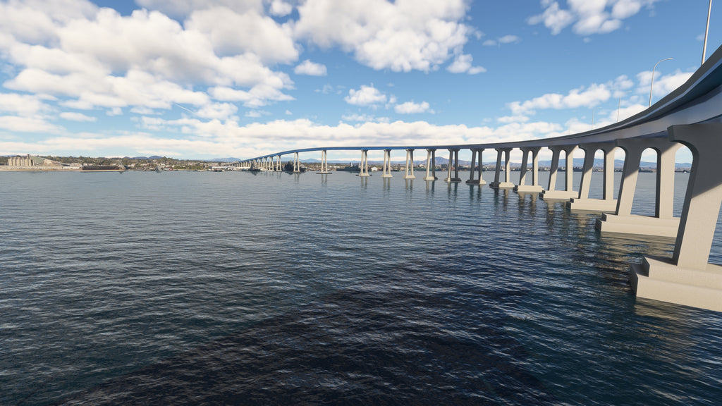
- Coronado Bridge
- Cabrillo Bridge
- Harbor Blvd. Pedestrian Bridge
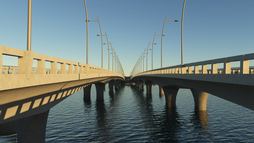
- Mission Bay Bridges (inc. new Mission Bay Drive Bridge)
- Bankers Hill Bridges (1st Ave., Quince St., Spruce St.)
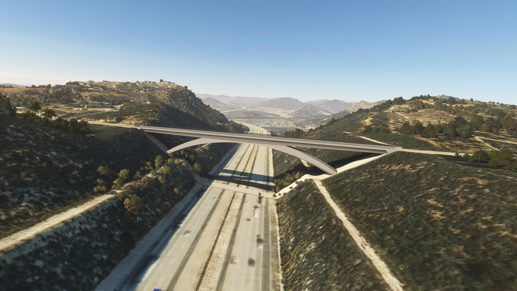
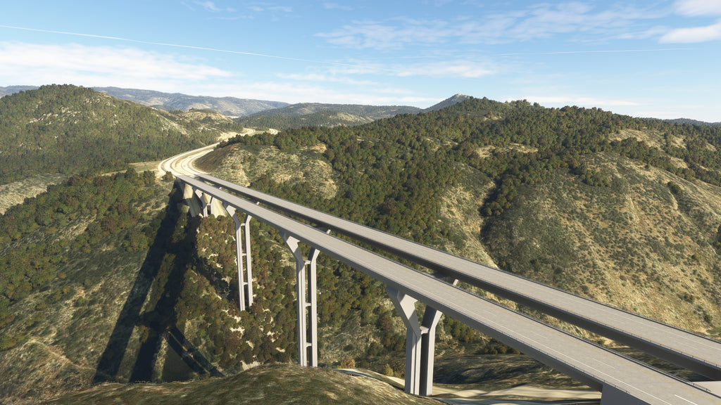
- I-8 Pine Valley Creek Bridge
- I-8 Sweetwater River Bridge
- I-8 Kitchen Creek Bridge
- I-8 La Posta Creek Bridge
- Lilac Bridge
- Eastgate Mall Bridge
- Adams Bridge
- I-805 Mission Valley Viaduct
- CA-125 Otay River Bridge
- Torrey Pines Bridges
- San Dieguito Rail Trestle (Del Mar)
- and many others
A large number of freeway interchanges are also hand-modeled and included, covering every interchange on I-5 and I-805 from CA-54 in the south to the CA-56 interchange in the north, along with many other interchanges on I-8 and CA-94 (See project map for more information). The number of included interchanges is somewhat unusual compared to my other bridge packages, but with San Diego's severe terrain, I found that properly modeling these was essential to obtaining the right look from above.
Each bridge/interchange is fully hand-modeled to a high degree of accuracy and detail, and includes PBR materials, custom lighting, and accurate road striping; many also include customized details such as custom-modeled light fixtures, hand rails, highway signs, and/or toll plazas. All bridges utilize LOD models tuned to balance appearance and performance. Most bridges include terraforming and vegetation corrections in the vicinity for the best possible appearance. Bridge approaches are modeled where they exist in real life, so photogrammetry should not be needed (though still recommended).
In addition to modeled bridges, this package also includes extensive shoreline corrections around Coronado, Point Loma, Naval Station San Diego, Mission Bay, Mission Valley, and the tidal lagoons from Torrey Pines to as far north as Oceanside. I've also included my custom vegetation hand-corrections for Balboa Park.
Compatibility notes: this package has been tested in conjunction with major payware scenery including SamScene San Diego Modern City, KSAN by both LatinVFR and BMW; and various freeware airports for the area, with no major issues noted. Nevertheless, I recommend using the in-game Package Reorder Tool to place this scenery package on a higher layer than any others for the area.
Extras: optional seasonal lighting packages for the concrete supports of the Coronado Bridge (proposed, but not yet implemented on the actual bridge)
Available since
2025-10-07
Supported Simulators
Microsoft Flight Simulator 2020 and 2024
MSFS 2024 Native
Yes
Version
v1.0.0
Supported Operating System
Windows
Installation Method
Contrail App
Download Size
143.6 MB
Installation Size
175.3 MB
Gallery


